| |
—
SPRING 2016 UPDATE —
 Collaborative
Area Management Plan Collaborative
Area Management Plan
After
two years of work that began in 2014, the Friends of Redington
Pass has completed the Collaborative Area Management Plan (CAMP)
recommendations and submitted them to the Santa Catalina Ranger’s
District of the Coronado National Forest (CNF) for review and
consideration. Below is the Friends Executive Summary
of the Report. You can download the full Report
and accompanying small
map (screen resolution) or large
map (print resolution). The CAMP recommendations
are the result of collaboration across a broad community of users
and user groups committed to the stewardship of Redington Pass.
Together, they have created a plan that is based upon balanced
recreation and CNF policy to establish a foundation for shared
stewardship and enjoyment for future generations.
We would like to thank all the members of the CAMP process who
committed over a year of their time in meetings, field trips,
research, and draft reviews. Most importantly, we have appreciated
their willingness to work together to make Redington Pass a more
enjoyable and accessible destination for all visitors. Despite
their many differences, they built on the shared values that grew
out of early community meetings and discussions in 2014. See Camp
Values below for a description of those shared values.
We look forward to continuing to build our network of partner
groups and organizations and to collaborate with CNF and other
federal, state and local agencies in furtherance of the many recommendations
developed through the CAMP process. After the District has had
a chance to review the CAMP report and consider how to move forward
to subsequent public review, we hope to host another community
meeting, hopefully in the early fall 2016.
Friends
Executive Summary
Friends of Redington Pass convened a Collaborative Area Management
Plan (CAMP) process for Redington Pass in 2014. That process brought
together a diverse array of people who appreciate the Pass and
want to assure it continues to provide multiple beneficial recreational
opportunities while maintaining its unique back country environment.
A broad range of user groups including hikers and mountain bikers,
high clearance highway vehicles and all terrain vehicle riders
and motor cyclists, conservationists, horseback riders, hunters
and recreational target shooters, the area ranching permittee,
and neighborhood associations and adjacent landowners came together
to work on four major issue areas that were identified through
extensive community scoping: recreational access, recreational
target shooting, high use areas, and conflicts among users.
The CAMP recommendations are the result of over a year of study,
deliberation, negotiation and consensus building by the CAMP working
groups. A synthesis of these recommendations has been organized
into five areas:
• Recreational Activities by Location (Western Slope, Central
Plateau, Eastern Section);
• Enforcement;
• Services and Facilities;
• Orientation and Education; and
• Monitoring Conditions.
Chief among the recommendations are: the strategy to enhance hiking
and mountain biking opportunities along the Western Slope accessible
to those with low-clearance vehicles; an adaptive management plan
for both designated target shooting areas and dispersed shooting
primarily in the Central Plateau of the Pass; maintenance of existing
forest service roads and study of some additional connector loops;
and improvements for parking, staging areas, signage and other
needed services and infrastructure. Where possible, these recommendations
come with suggestions for partnering and funding opportunities
to assist the Forest Service in carrying out these recommendations.
The full report and its attachments have been conveyed to the
Santa Catalina Ranger’s District of the Coronado National
Forest for review and consideration.
CAMP
Values
What
People Appreciate about Redington Pass
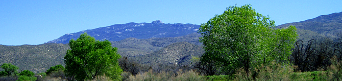
Its Rural Backcountry Landscape
reveals an open desert mountain pass with scenic panoramas, broad
plateaus, and diverse undeveloped landscape features.
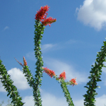
Its Crossroads Location
links two watersheds east to west and two mountain ranges north
to south, providing habitat for diverse plants and animals and
multiple access points and corridors for wildlife movement and
human recreation.
Its Lasting Quality
offers visible reminders of the natural and human history of the
Southwest still preserved as public lands in an unfragmented landscape.
Its Open Accessibility
makes multiple outdoor recreational opportunities freely available
to enjoy by many people in close proximity to Tucson.
Its Road and Trail Network
attracts a highly diverse range of motorized and non-motorized
uses as well as access to more distant backcountry destinations.
Its Rugged Outback Nature
creates opportunities for independent recreational adventures
shared with others or experienced on one’s own.
It's Our Pass shared
with thousands of people over the decades who hold memories and
personal connections to their experiences in Redington Pass.
|
|